Quoted from the book: A geographical, statistical, and historical description of Hindostan and the adjacent countries
Walter Hamilton (M.R.A.S.), 1820
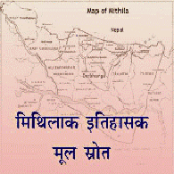
THE DISTRICT OF TIRHOOT
Trihuta
This district occupies the north western corner of the Bahar province and is situated principally between the 27th and 28th degrees of north latitude. To the north it is bounded by the jungle territories of Saptari belonging to Nepaul to the south by the great Ganges on the east is the Bengal district of Purneah and on the west the district of Sarun.
In 1784 Tirhoot was estimated to contain in all its dimensions 5033 square miles but since that period it has been variously modified By Abul Fazel in 1582 it is described as follows Circar Tirhoot containing 74 mahals measurement 266,464 begahs Revenue 19,179,777 dams.
This Circar furnishes 700 cavalry and 80,000 infantry Although not hilly the surface of Tirhoot is more elevated the soil drier and the climate in general healthier than those more to the south yet during the summer the heat is intense For agricultural purposes it is plentifully supplied with water from various small rivers and where these are not in existence tanks and reservoirs have been constructed In a particular quarter embankments of considerable strength and elevation are necessary to contain the waters of the great Gunduck river which occasionally overflows these dikes and inundates vast tracts of country from Karnoul to Hajypoor sweeping away whole villages with all their cattle inhabitants and woods This district throughout is in general well cultivated but in the north and south tracts of waste land are found contiguous to old zemindaries which having remained in a state of nature and without occupant for many years leave the boundaries of these estates undefined and give rise to much litigation and frequent affrays The cultivation of the soil has notwithstanding greatly advanced since the first year of the decennial settlement of the land revenue and continues progressively to increase much waste being annually reclaimed and brought under tillage or converted into pasture The most valuable exportable commodities produced are sugar indigo saltpetre opium tobacco pawn turmeric ginger and rice Towards the northern frontier there are extensive forests but no supply of timber deserving of note can be procured for want of depth of water in the rivers Could this be remedied large quantities might be obtained The principal rivers are the great Gunduck a boundary one the Bhagmati and the Goggary.
In 1802 the cultivated lands were supposed to bear the proportion of three to two uncultivated but the last probably includes land under fallow and the produce of the rent free lands the proportion of 1 to 4 of those paying revenue to government the cultivation of both appeared on an equality In 1814 the jumma or land assessment to the revenue amounted to 1,234,680 rupees and the abkarry to 40,037 rupees The saline composition named Khari is manufactured in considerable quantities not far from the Ganges about 8 miles east of Singhea The saline earth from which this is made is called Reher and effloresces in several pergunnahs in the districts of Tirhoot and Sarun and is scraped together and collected at the furnace A little rice straw is then placed on the ground and covered with saline earth to the thickness of about 4 inches The straw is then burned and the burned matter is covered with a foot of straw and this straw is also burned which process is repeated seven times after which the heap is covered with some fire wood and burned The burned saline matter is then dissolved in water and boiled When the operation has succeeded well a whitish salt in grains is procured which is given to cattle when it does not succeed a black salt is procured in a mass from which an excellent purging salt may be extracted At present there are no brick or mud forts nor is any species of fortification to be seen or any remarkable public building if we except the jail which is always the most conspicuous ornament of a Bengal district and generally well populated.
During Lord Minto’s administration in 1811 it was proposed in council to establish a Hindoo college at Bhowra in Tirhoot which had always been a hot bed of superstition upon the plan of the institution at Nuddea in the Bengal province. The establishment was intended to consist of 2 pundits at 100 rupees per month each and 10 pundits at 60 rupees per month the whole annual expenditure including the library stationary and prizes not to exceed the sum of 12,472 rupees. The highest prize was fixed at 800 rupees the second 400 the third 200 and the fourth 100 rupees and for the good scholars an honorary dress consisting of a cloth of little value.
On account of its natural advantages in soil and climate this district was originally selected by the British government as an eligible station for improving the breed of horses in their territories the aboriginal race of Bengal being of the most contemptible description and scarcely larger than mastiffs A low and marshy soil seems uncongenial to the nature of this most noble animal which there degenerates immediately while it appears to thrive in arid tracts almost destitute of water Many horses of the first quality have been reared in the Hajypoor division of this district and horse dealers from Upper Hindostan the fairs to purchase them. A considerable number are also annually at the Government stud for mounting the King’s and Company’s cavalry besides those reared by the zemindars and others throughout the country Tivabhucti corrupted into Tirhoot was in the remote eras of Hindoo antiquity a component part of Maithila an ancient division of India which a great proportion of three districts Tirhoot Purneah and Sarun at under the British government and also part of the adjacent territory by the Nepaulese The limits of the whole were the Gunduck and Cosa rivers and the Nepaul mountains and within these territories a distinct dialect spoken still named the Maithila or Trihutya.
During the wars of the Ramayuna its sovereign was named Janaca whose daughter the far famed Seeta the great Rama whose exploits are narrated in that mythological poem Tirhoot appears to have continued an independent Hindoo principality until AD 1237 when it was invaded by Toghan Khan the Mahommedan governor of Bengal who extorted a large sum of money from the Raja but did not retain possession of the territory. It was finally subdued about AD 1325 by the Emperor Allah ud Deen who annexed it to the throne of Delhi. Along with the rest of the province it devolved to the British government in 1765 but was not permanently assessed for the revenue until 1794. In 1801 when the population returns were ordered by the Marquis Wellesley the inhabitants within the jurisdiction of the magistrate of this district were estimated at 2,000,000 in the proportion of 1 Mahommedan to 4 Hindoos The principal towns are Hajypoor, Singhea, Durbunga and Mowah In 1814 the general controul exercised by the magistrate over the police stations was considered as efficient as the great extent of the district and immense population would admit Crimes of enormity were not frequent nor were burglary and the lesser offences of frequent recurrence although from the recent institution and augmented vigilance of the village watchmen a comparative increase appeared in the official reports J Grant Colebrooke F Buchanan Stewart &c &c &c